Travel-Maine.Info
|
Main Menu
Home
Blog
FALL
Fall Foliage
Apple Orchards
Halloween
Hunting
Thanksgiving
WINTER
Alpine Skiing
Nordic Skiing
Snowmobiling
Ice Fishing
Dogsledding
Snowshoeing
SPRING
Maple Syrup
SUMMER
Biking
Birding
Seacoast
Whitewater Rafting
Kayaking
Camping
Hiking
Fishing
Summer Camps
Windjammers
THINGS TO DO
Vacation Planner
Shopping
Places to Visit
Recreation
Forts
Lighthouses
Museums
HELPFUL PAGES
Cities & Towns
Maine Blogs
Maps
Maine News Media
Books about Maine
Business Directory
Business Services
Real Estate
Oxford Forest Preserve
The Oxford Forest Preserve in Oxford, Maine was established by the Western Foothills Land Trust (WFLT) in early 2024. This 83-acre tract of land is located between Allen Hill Road and the Little Androscoggin River, near the center of Oxford Village. It has 1,140 feet of frontage along the Little Androscoggin River.
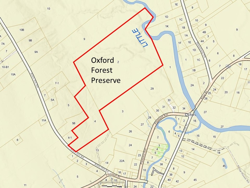
Click here for larger image of the above map
Activities at the Oxford Forest Preserve include hiking, snowshoeing, backcountry touring, mountain biking, fishing, equestrian pursuits, and snowmobiling on the ITS 89 trail. It is also located not far from the Smith Bridge Preserve, also in Oxford on Allen Hill Road.
The parcel of land was acquired through the efforts of the Chadbourne Tree Farm Partnership of which the Western Foothills Land Trust is a member. The Oxford Forest Preserve has been called, in the past, the Staples Forest. On the Town of Oxford map plan the preserve is located at map R5 lots 3 and 4.
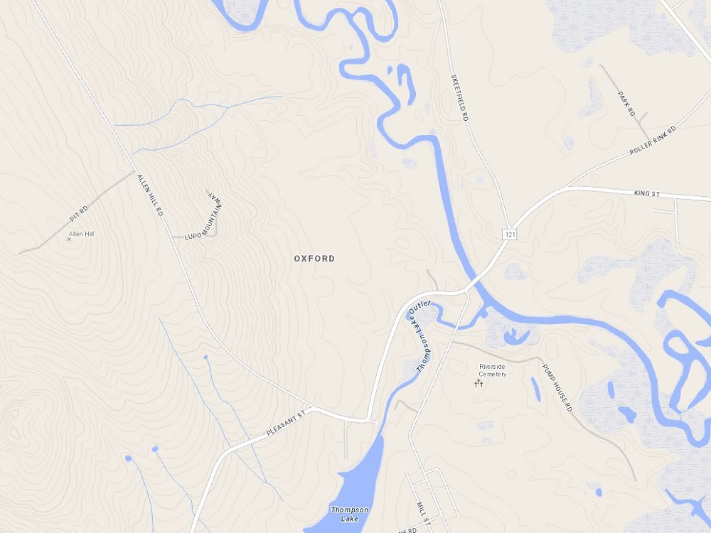
Topo Map of Oxford Forest Preserve - MaineDOT
Public Map Viewer
Click here for
larger image of the above map
News Articles about the Oxford Forest Preserve
"Land Trust Creates Oxford Forest Preserve", Advertiser Democrat, March 7, 2024. file:///C:/My Webs/travel-maine/images/city/oxford/oxford-forest-preserve-advertiser-democrat-7mar2024.jpg or at https://www.sunjournal.com/2024/03/07/land-trust-creates-oxford-forest-preserve/
|
AdsThe website is an Amazon Associate and earns money for qualifying purchases.
|
|
|